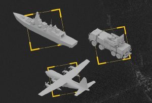


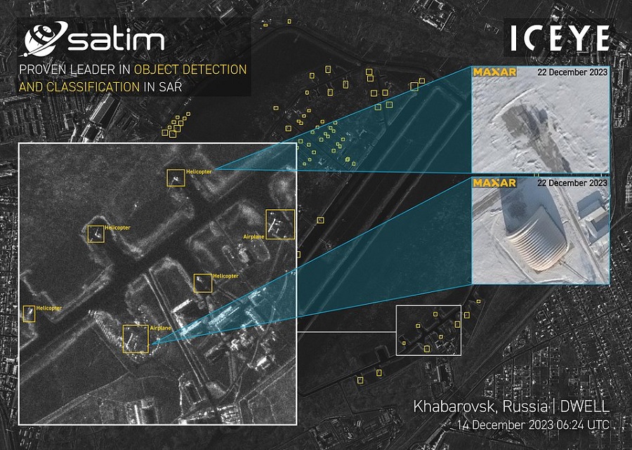
The product bundles ICEYE imagery with SATIM’s AI-based derivatives, delivering SAR images alongside detections and classifications in one package. This enables defence and intelligence analysts to access rapid situational awareness across maritime, air, and land domains.
Detect & Classify addresses the long-standing challenge of time-consuming manual SAR data analysis. By automating this process, the product reduces reliance on SAR experts and delivers actionable insights within the same timelines as ICEYE’s rapid imagery services, often within hours or minutes.
According to ICEYE, the solution will enable intelligence analysts to establish behaviour patterns more quickly and allow tactical teams and maritime forces to locate, classify, and respond to assets with greater efficiency. These capabilities are aimed at strengthening missions involving armed forces and intelligence agencies.
“Our goal with Detect & Classify is to empower our customers to make faster, more informed decisions with less effort,” said John Cartwright, Senior VP of Data Product at ICEYE. “This is more than just an analytics tool — we’re eliminating a bottleneck between satellite imagery pixels and decision-making, giving our users near-instant situational awareness. And it’s a transformative step on the path towards ‘lights-out,’ machine-driven satellite imaging operations. That’s a fundamental shift for defense, security, and intelligence operations that use satellite imagery.”
Jacek Strzelczyk, CEO of SATIM, commented: “Combining SATIM’s extensive object catalog with ICEYE’s high-fidelity SAR imagery creates a powerful product that eliminates manual analysis bottlenecks and provides customers with direct access to actionable intelligence, improving situational awareness and accelerating critical decisions. We’ve seen significant uptake of our products with customers around the globe, and this product will expand this benefit to a wider range of customers.”
ICEYE operates the world’s largest SAR satellite constellation, providing 25 cm ground resolution and frequent global revisit capabilities. To date, the company has launched 54 SAR satellites, supporting customers with imaging in all weather and lighting conditions.