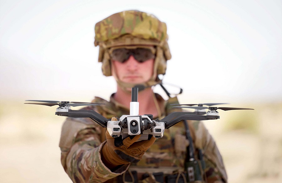
The Black Widow, currently part of the U.S. Army’s Short Range Reconnaissance programme of record, completed a series of flights under both normal and GPS-denied conditions. These included high-speed, low-altitude, and low-light scenarios, with no need for new hardware.
“This is a breakthrough moment not just for Red Cat, but for the tactical needs of the Department of War,” said Jeff Thompson, CEO of Red Cat. “Every battlefield is a GPS-denied environment, and this successful test shows that Red Cat and Palantir are delivering a software-driven solution the Army can rely on. It requires no new hardware, is ready to deploy today, and gives warfighters the edge in contested environments. It also signals our evolution into a full-stack defense technology platform, with expected margin expansion and strong revenue potential in 2026.”
VNav uses edge-based sensor fusion to produce real-time position estimates from visual and inertial inputs. During the tests, the drone completed a simulated reconnaissance mission without GPS or human input, navigating to a target, performing surveillance, and returning with consistent positional awareness.
Palantir reported a mean positional error of about seven metres over a 2.7-kilometre route. “Palantir Visual Navigation performed well in real-world conditions,” said Akash Jain, President and CTO, Palantir USG. “This demonstrates our approach to visual navigation in disrupted environments –– delivering intelligent software that adapts, scales across platforms like Black Widow, and supports the Army’s integrated operating systems.”
Red Cat and Palantir now aim to present VNav in a formal demonstration for the U.S. Army, with plans to expand its deployment across all fielded Black Widow systems.