For your convenience, you can read this article in .pdf format.
UAVs and Wildforest Protection
UAVs and RPAS have revolutionized wild forest protection and fire watch duties by providing unmatched capabilities in surveying vast, hard-to-reach areas with an intense topography. Equipped with high-resolution cameras, infrared sensors, and multi-spectral imagery technology, these unmanned systems offer an array of benefits:
- Early Detection: UAVs can swiftly and regularly monitor remote regions, detecting fire ignitions at their nascent stages. This early detection minimizes response time, preventing small fires from escalating into uncontrollable infernos.
- Surveillance and Monitoring: UAVs can provide real-time surveillance over large expanses of wild forests, enabling firefighting authorities to detect illegal activities that could potentially lead to wildfires. Moreover, continuous monitoring assists in tracking the progression of ongoing fires and identifying changing patterns due to meteorological conditions or vegetation density.
- Risk Assessment: By analyzing vegetation density, moisture content, and topographical features, UAVs and RPAS contribute to accurately extracting risk assessments. These data aid in strategizing preventive measures, allocating resources effectively, and predicting fire behavior patterns.
- Mapping and Visualization: The data collected by these systems can be used to generate accurate and up-to-date maps of the affected areas. This aids firefighting crews in understanding the fire’s scope and planning their operations accordingly.

The Role of UAVs in Forest Firefighting Mission Coordination
UAVs have emerged as invaluable assets for coordinating firefighting efforts across large and intricate fire zones. By leveraging their capabilities, firefighting agencies can achieve improved situational awareness (SA), enhanced communication, and streamlined response coordination. Using UAVs as on-scene coordinators (OSC) presents a wide spectrum of advantages, such as:
- Real-time Aerial Reconnaissance: UAVs equipped with high-definition (HD) cameras, infrared (IR) sensors, and multispectral imaging systems provide real-time imagery of the fire’s progression and behavior, as well as weather conditions. Through live video feeds and data feeds from UAV sensors, commanding authorities can identify and guide the positions of the firefighting teams. These comprehensive visualized data aid in accurate decision-making by providing up-to-date information to fire commanders and civil protection command centers.
- Mapping and Data Integration: Through Geographic Information System (GIS) data combined with UAV-generated maps, UAVs offer a holistic view of the fire’s extent, terrain, and surrounding infrastructure. RPAS equipped with specialized sensors can identify hazardous conditions like fast-spreading fires, sudden shifts in wind direction, or dangerous terrain, allowing firefighters to adapt their strategies accordingly. Integrating these data sources enhances the comprehension of the operational environment and assists in resource allocation and prioritizing firefighting mission objectives.
- Rapid Information Sharing: UAVs act as communication relays between ground teams and command centers. They transmit critical updates, evacuation notices, and resource requests, ensuring that everyone involved is well-informed and able to respond effectively, thus improving coordination among ground and aerial units. This real-time data distribution streamlines efforts and helps avoid duplication of tasks.
- Strategic Resource Allocation: By analyzing UAV-acquired data, firefighting commanders can optimize the deployment of resources, positioning crews and equipment precisely where they are needed most. This prevents resource wastage, maximizes firefighting impact, enhances decision-making, and ensures the safety of firefighting personnel.

The operational deployment of IAI HERON in Summer 2023 Greek wildfires
Since 2021, the Greek Armed Forces deployed their HERON unmanned aircraft to assist in coordinating firefighting efforts across the country. The impressive surveillance capabilities of the HERON system are now fully available to the Unified Coordination Center of Operations and Crisis Management of the Civil Protection Authority in the wildfires firefighting operations.
Using the accumulated operational experience of HERON UAV in surveillance and intelligence-gathering missions in the Aegean and the SE Mediterranean, the Armed Forces have deployed the Israeli-made unmanned aircraft in order to coordinate the firefighting forces operating in various locations and monitor the endangering forest territory of the country in long-endurance fire watch missions.

Many fires tore across parts of Greece in July 2023 and dozens more fires ignited across the country in late August 2023. During this unprecedented national emergency, the HERON UAV of the 390 Unmanned Aircraft Squadron took off from its operational detachment on the 135 Combat Wing in Skyros as part of the coordination effort in the battle against raging wildfire outbreaks. For the next few days, it conducted surveillance flights in mainland Greece and assisted in firefighting mission coordination where needed. The proven system reliability, the minimized turn-around times, and the highly trained operational crews of the HERON system allowed Greek authorities to maintain a “sleepless electronic eye” over the entirety of Greek territory at any given moment.
This constant readiness state proved to be extremely useful when the wildfire in Rhodes got out of control and threatened many inhabited areas with extensive tourist activity. The HERON aircraft moved quickly to the critical zone, providing high-resolution imagery to the National Center of Operations and then to all participating agencies in the coordination efforts, recording the developments of the wildfire fronts with impressive accuracy.
The HERON provided valuable information essential for coordinating both ground and aerial resources. Flying at medium and high altitudes above firefighting aircraft, continuously for 12-14 hours, it provided essential coordination of resources based on the imagery intelligence and live video feed sent to the coordination center.

The specialized operational equipment of the IAI HERON UAV
The HERON UAV system plays a crucial role in enhancing the efficiency and effectiveness of firefighting missions through its advanced operational equipment and coordination capabilities. The HERON aircraft is equipped with a range of specialized sensors, systems, and technologies designed to aid in the operational coordination of ground forces whether it concerns a military operation or a civil protection one.
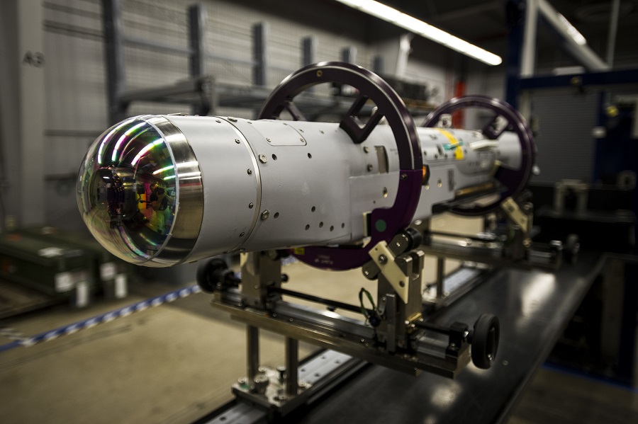
One of the primary sensors of HERON UAV in firefighting missions is real-time imagery data collection through the IAI/TAMAM MOSP3000-HD Electro-Optical airborne camera. MOSP3000-HD is a single LRU, High-Definition multi-sensors aerial payload with HD detectors for both thermal and day channels, tailored for persistent surveillance missions due to its high resolution wider Field of Views (FOV), more than 4 times compared to standard IR and 6 times compared to standard TV. MOSP3000-HD provides long-range acquisition due to its powerful sensors, high stabilization, in-flight bore sight capability, and unique image processing. MOSP3000-HD reduces operator workloads and improves its situational awareness due to its multimode Automatic Video Tracker (AVT) and video symbology overlay.

Equipped with this high-resolution camera, coupled with infrared sensors, and detailed tracking technology, HERON UAV can provide firefighting forces with accurate and up-to-date information about the fire’s location, size, and behavior. Detailed thermal imaging allows operators to track the spread of the fire and assess the impact of suppression tactics in real time. This continuous feedback loop enables adjustments to the strategy as needed, leading to more efficient containment, and extinguishing of the blaze. With live video feeds and aerial imagery, firefighters can gain a comprehensive understanding of the fire’s progression, even in hard-to-reach or dangerous areas. This insight helps teams identify potential hazards and prioritize their actions, ensuring the safety of both personnel and resources.
HERON UAV is also equipped with an airborne radar, which plays a critical role in enhancing the coordination of aerial firefighting missions. The integration of the IAI/ELTA ELM-2022U radar technology into the HERON UAV provides invaluable capabilities that significantly improve situational awareness, resource allocation, and overall effectiveness in combating wildfires from the air. The ELM-2022U is a combat-proven long-range airborne multimode maritime surveillance radar designed for deployment on UAVs. Operating in X Band, the ELM-2022U radar is a true all-weather, day and night sensor capable of penetrating clouds, rain, smoke, smog, fog, man-made and natural camouflage. This radar provides detailed Environmental Control and Weather Observation, Air-to-Air Surveillance, Air-to-Ground Intelligence, Reconnaissance and Surveillance (ISR) mission capability, and mainly Strip/Spot/Inverted Synthetic Aperture Radar (SAR/ISAR) imaging and GMTI (Ground Moving Target Indicator) tracking for ISR support of ground forces.
The airborne radar system of the HERON UAV is designed to penetrate through thick layers of smoke and other challenging environmental conditions, thus enabling multi-spectral detection and tracking of the fire’s location, boundaries, and intensity even when visibility is severely limited. This real-time radar data offers on-scene commanders and firefighting teams an accurate depiction of the fire’s dynamics, helping them to strategize and deploy resources more effectively.
By continuously monitoring the congested airspace over a wildfire operations area, the radar-equipped HERON UAV also enhances communication and coordination among various aerial firefighting assets. By relaying radar-generated flight track data to command centers, HERON UAV facilitates ATC (Air Traffic Control) workload and accelerates crucial real-time decision-making regarding the seamless coordination of aircraft, ground crews, and support teams. This comprehensive display of information about the aerial firefighting airspace contributes to the safety of aerial firefighting operations. The SAR and ISAR imagery data of the ELM-2022U radar can identify hazards such as extended power lines towers or large-scale obstacles that might pose risks to firefighting aircraft. In addition, the real-time informational depiction of all flight tracks above the area of operations ensures that aircraft operate in safer conditions with augmented situational awareness (SA) and enhances the overall success of fire suppression efforts.

In summary, the HERON UAV with its airborne radar equipment offers a game-changing advantage in coordinating aerial firefighting missions. The unparalleled ability to see through challenging conditions, depict fire movement, and provide real-time ATC data empowers firefighting teams to respond proactively, allocate resources wisely, and ultimately enhance the efficiency and safety of aerial firefighting operations.
The HERON UAV possesses a crucial capability to share and transmit operational information to other stations, greatly enhancing the coordination of both aerial and ground firefighting missions. This ability to facilitate real-time data exchange plays a pivotal role in ensuring efficient communication, timely decision-making, and optimized resource deployment.
HERON UAV has the ability to act as airborne information hubs, relaying critical data collected from their sensors and cameras to command centers, ground crews, and other relevant stations. This information includes live video feeds, aerial imagery, GPS coordinates, fire behavior analysis, and other mission-critical details. By providing a comprehensive and up-to-date visual of the firefighting situation, HERON UAV enables remote teams to move safely and efficiently inside the area of operations despite all the challenging and rapidly changing conditions.
Moreover, the ability of HERON UAV to transmit operational information in real-time enhances communication among different firefighting units and agencies. Ground forces, airtanker pilots, support teams, and command centers can all access the same data simultaneously, fostering a synchronized response effort. This collaborative approach minimizes the risk of miscommunication and ensures that everyone is working towards a unified goal. HERON UAV helps coordinate the movements of firefighting crews, aircraft, and ground vehicles, optimizing the allocation of resources and minimizing duplication of efforts. This is feasible via the CRISP (Commander’s Remote Imagery & Situation Picture) system, which is a data-sharing platform for operational information about the situational and conditional understanding among all stakeholders involved in the firefighting mission.

IAI CRISP system is a Collaboration subsystem for HERON UAV missions, to be used at posts and Coordination Centers. CRISP web system provides remote capabilities via multiple connections through the IAI web portal to real-time mission intelligence by using secured and encrypted personal links to a web server in the ground station without any need for additional installations.
CRISP web system enables users at all sites to share the operational picture by displaying: RPAS location and footprint, live payload video, exchanging information and messages, and even holding video conferences.
CRISP transmits live, secured, and encrypted information from the Ground Control Station to external Coordination Centers using a web portal. Through this connection protocol, a large piece of information can be shared, such as:
- Live EO/IR imagery (Electro-Optical/Infrared).
- Live radar display and reported objects
- Live data from any other operational payload (i.e. GSM and SAT phone locators, EPIRB locator, etc.)
- Live collaboration and communication relay
- Live exchange of chat, messages, and video conferencing
The HERON UAV’s role extends beyond providing intelligence to the immediate firefighting teams. It facilitates coordination with local authorities and public emergency management agencies. By sharing real-time information on the fire’s status and containment progress, HERON UAV helps keep all the agencies informed thus enhancing safety awareness and enabling timely evacuations if necessary.

In conclusion, HERON UAV’s ability to share and transmit operational information to various stations is a vital asset in the coordination of aerial firefighting missions. Its role as a data relay platform empowers different teams to work together seamlessly, make informed decisions, and respond effectively to the challenges posed by wildfires. This capability ultimately leads to more successful and safer firefighting operations.
Challenges and Future Prospects of the Deployment of UAVs in Forest Fire Operations
The deployment of UAVs in forest fire operations presents both significant challenges and promising future prospects. While UAVs and RPAS offer unprecedented advantages, their operational integration is not without challenges. The main and most important challenges are:
- Regulations and Airspace Management: Stringent regulations govern UAV and RPAS usage in many regions to ensure safety and prevent conflicts with manned aircraft. Striking a balance between operational flexibility and compliance remains a challenge. Integrating UAVs and ISR systems with existing firefighting infrastructure and protocols requires careful planning to ensure compatibility and coherent communication.
- Technological Limitations: UAVs have limitations in terms of flight endurance, payload capacity, and communication range. Overcoming these limitations through advancements in fuel-efficient propulsion technology, long-range communication systems, and secure satellite connection is a crucial goal.
- Data Processing and Analysis: The sheer volume of data collected by UAVs and RPAS can be overwhelming. Efficient data processing and analysis tools are needed to transform raw data into actionable insights in real-time and transmit them in a short time to everyone involved. This procedure requires next-gen super-processors with immense computing power and increased energy efficiency.
- Human Element: While UAVs can perform tasks with precision, human expertise remains essential for decision-making, especially in complex and unpredictable wildfire scenarios. The continuous operational training of crews and the detailed specialization should remain a top priority for all the organizations involved. The greater goal is to ensure that UAV operators, mission crews, and aerial firefighting personnel are well-trained and compliant with the latest aviation regulations, which is vital to the successful integration of new technologies on the firefighting front.

Despite these challenges, the future prospects for UAVs in forest fire operations are encouraging. Advancements in sensor technology, such as improved thermal imaging and sophisticated aerial mapping, enhance UAVs’ ability to gather accurate and actionable data for rapid response and strategic planning. AI-driven algorithms can predict fire behavior more precisely, aiding in containment strategies. As regulations evolve and collaboration between stakeholders strengthens, UAVs are poised to revolutionize forest fire management by offering quicker, safer, and more efficient ways to combat these natural disasters.
Conclusions
The operational use of UAVs and RPAS in wildforest protection, fire watch duties, and firefighting operations coordination represents a significant leap forward in how we manage and combat wildfires. These technological breakthroughs offer early detection, real-time situational awareness, resource optimization, intelligence sharing, and enhanced communication. While challenges remain, the potential to save lives, protect ecosystems, reduce property damage, and mitigate the devastation risk caused by wildfires makes the integration of UAVs and RPAS a critical advancement in modern firefighting strategies. As technology continues to evolve, so will our ability to safeguard our precious wildforests and communities from the ever-growing threat of wildfires. By embracing and integrating these innovative technologies, firefighting agencies can continue to evolve and adapt their strategies to the new climate conditions, ensuring the effective and efficient management of forest fire incidents in the years to come, through the operational deployment of modern UAV systems.
About the author:

Dimitrios Kalogiannis
Captain, Hellenic Air Force (HAF)
RPAS Pilot/Mission Commander (MC) of 390 UAV Sqn
MA in Governance, Development, and Security in the Mediterranean
MA in International and European Relations
PhD Candidate NKUA


